STAC Powered
A suite of STAC-focused technologies that consistently perform well as a backend
eoAPI
eoAPI makes massive earth observation (EO) data archives discoverable and interoperable—the fastest and easiest way to configure, customize, and deploy a full Earth Observation stack.
eoAPI presents an open-source and reusable framework for harnessing earth observation data. eoAPI takes the work out of constructing a cloud-native EO infrastructure through a set of sensible defaults that fit most EO and geospatial infrastructure needs. Built with modularity as a core principle, eoAPI can easily be customized to your needs.
A suite of STAC-focused technologies that consistently perform well as a backend
Seamless deployment, configuration, and customization while preserving flexibility.
Quickly deploy, configure, and scale EO services, anywhere.
pg-STAC is an optimized Postgres schema to index and search large-scale STAC collections.
stac-fastapi is an Open Geospatial Consortium (OGC) Features API compliant FastAPI application for STAC metadata search.
titiler-pgSTAC is a TiTiler extension that connects to pgSTAC to support large-scale dynamic mosaic tiling for visualizing STAC collections and items.
stac-utils/titiler-pgstactipg is an Open Geospatial Consortium (OGC) Features and Tiles API for vector datasets.
developmentseed/tipg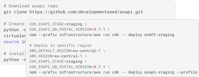
Get started by downloading all the eoAPI resources you need. With our easy-to-follow guides and documentation, you'll have eoAPI up and running in minutes.
Whether working with raster or vector data, eoAPI's flexible design allows you to ingest STAC Collections quickly.
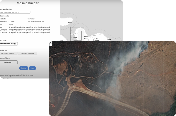
Now that your data is ingested, eoAPI provides the tools to share, visualize, and analyze it. From simple sharing options to advanced analytics capabilities, eoAPI is designed to help you make the most out of your geospatial data.
The potential of Earth Observation data is immense in helping us understand our ever-changing planet. To fulfill this potential, we must provide EO data that can be easily integrated into modern applications and decision-making tools. It's crucial that it's easy to discover, interoperable, ingestible, and optimized for applications. This is a significant challenge for many organizations, and our mission at Development Seed is to address this challenge.
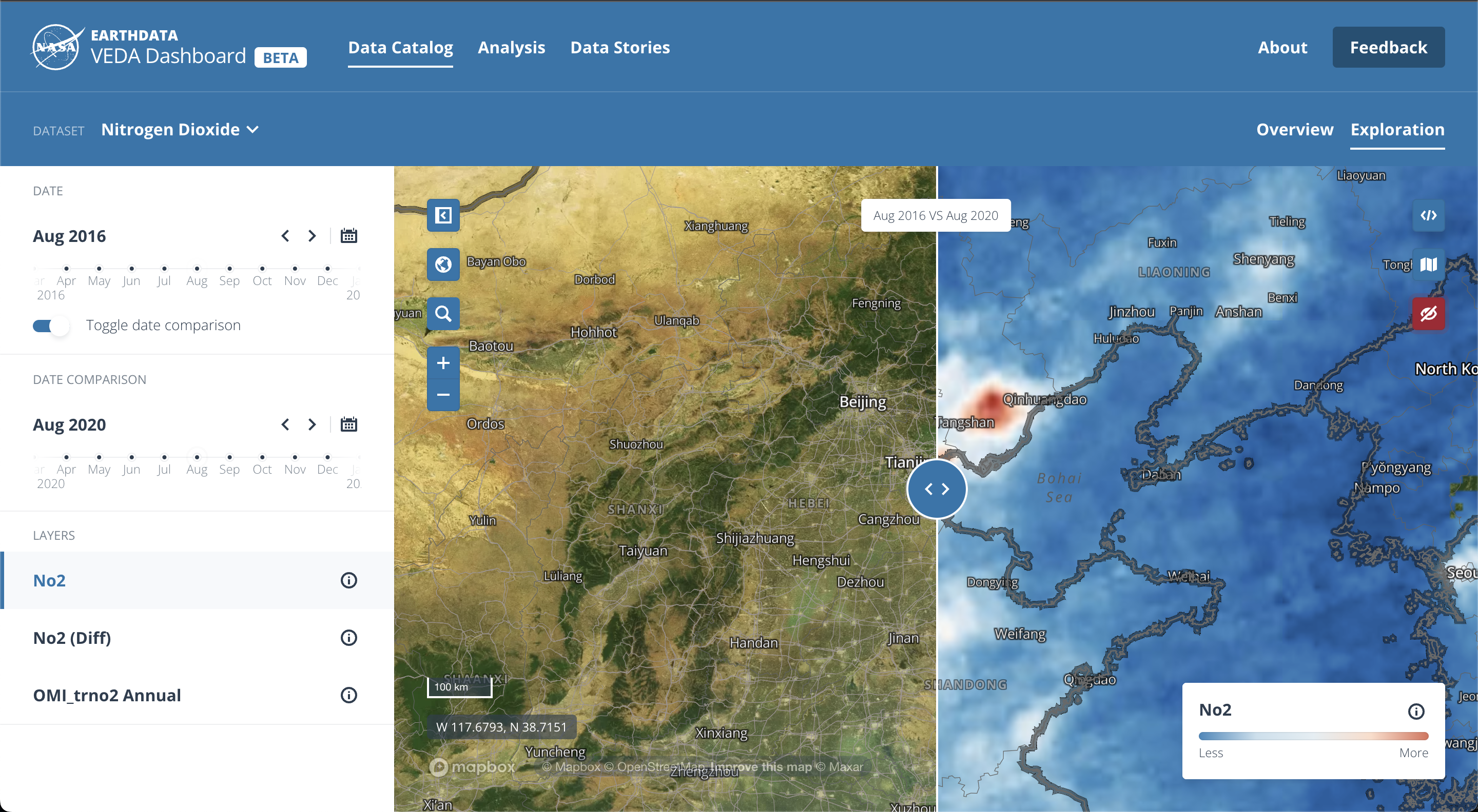
NASA IMPACT is leading the way for how NASA (and space agencies worldwide) can increase the societal impact of their data through cloud-optimized data distribution. They've invested significant resources in advancing modern public EO data standards, tools, and platforms. You can see eoAPI services in action throughout the VEDA platform.
eoAPI is a community-driven initiative built on collaboration. We welcome your contributions, feedback, and suggestions. Join the discussion or open a pull request in the eoAPI repository